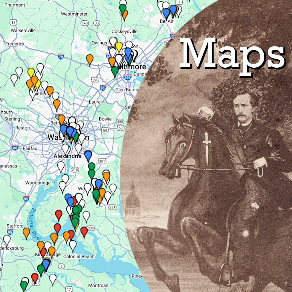
The assassination of Abraham Lincoln on April 14, 1865, was a defining moment in history. All over the United States (and the world) there are museums, graves, buildings and sites that are, in some way, connected to this defining event. What follows is the beginning of an ongoing project to document and map the countless sites that have some relevance to Lincoln’s assassination. The sites may be big and notable like Ford’s Theatre, small and peripheral like a hotel a conspirator stayed at, or may merely note a museum that currently owns an artifact related to the assassination. Different maps will be created for different regions of the U.S. along with an international map to show the global impact of Lincoln’s assassination. Maps will be continually updated with new locations and sites as research continues.
I have gone through and added the GPS coordinates for every site marked on the maps. This is not only for posterity’s sake, but also serves to improve the functionality of the maps themselves. Practically every “smart” cell phone built today has the capability of providing driving directions. With the GPS coordinates included in the description for every Lincoln assassination site, all you have to do is click the place you want to visit on my map, copy the GPS coordinates, and direct your phone or GPS device to give you directions there.
I am hoping these maps will prove helpful in not only documenting places of historic interest, but will also work as a guide for those who want to visit the sites in person.
Important Notes:
- On the top right hand corner of each map is an icon which looks like a frame. If you click that, it will open a larger version of the map in Google Maps. This provides an easier view where you can also switch between “earth” (aerial) and “map” view. The earth view is default as it is helpful in visited sites like cemeteries.
- Be sure to zoom in on an area of interest. Nearby markers can often hide behind each other if you are zoomed out too far.
- Use the earth view when viewing grave sites and utilize the GPS coordinates. In most cases, the markers on the map correspond to the exact location of the grave in the cemetery. When the exact location is not known, the marker has been placed at the entrance to the cemetery.
- If you plan on visiting the museums and cemeteries on these maps, always look up the days and hours of operation before you go. Also, many Lincoln assassination artifacts in museum collections are in storage and/or not available for viewing without a prearranged appointment. Do your homework if there’s something you really want to see.
- The places that are public or limited access/view sites are best visited by driving (or walking) by the location and taking a picture. Do not trespass on private lands.
These maps are works in progress and are always being added to. Check back continually to see what new sites have been added. If you have a suggestion for a site that should be added to a map, please comment below with the name of the site, its significance to the Lincoln assassination, and its address or GPS coordinates.
Key:
Blue = Museums and libraries
Green = Historical markers and sites
Orange = Public access/view sites
Yellow = Limited access/view sites
White = Graves
Red = No public access/view sites
D.C., Maryland, and the Northern Neck of Virginia
The Northeast
The South
The Midwest
The West
Internationally
These maps are for educational use only and can not be reproduced without permission.


Dave,
Could you pinpoint the “Navy Yard Bridge” where Booth and Herold exited DC on 4/14/1865? Was it at the same location as one of the two modern bridges? Thanks!
Rick,
The modern “Navy Yard Bridge” is extremely close to the one that Booth crossed over. Go here and use the slider at the top to see the bridge today and how it was during the Civil War: http://civilwardc.org/maps/flex/
Pingback: Mapping the Assassination | BoothieBarn
Great job Dave
Jim,
Shortly after New Year’s I would love to come up your way and have you show me some of the other Atzerodt sites so that I could add them to the map. What do you say?
Pingback: Assassination Maps Update | BoothieBarn
Your site never fails to amaze me. What a contribution you are making to Lincoln assassination studies – and history in general. Amazing.
This is high praise from the map master himself. Thank you, Kieran.
I hope everyone here has purchased one of Kieran’s expertly researched, illustrated, and annotated escape route maps: http://www.amazon.com/Wilkes-Booth-Escape-Route-HISTORY/dp/0986894532/
Pingback: Take an Assassination Vacation! | BoothieBarn
Pingback: Jumping John Surratt | BoothieBarn
Hi Dave
I look forward to your Boothiebarn emails. This map section is truly impressive. There is a lot of work here – and incredible detail. Thank you!
Kieran
Sorry it took me so long to get here…great site.
Thank you, Ed. Your ancestor’s diary noting the guards who kept watch over the conspirators at the Aresnal is a true gem.
I see there is a Grant Hall Trial Room open house on 11/7. If that date is official, I have to bring my wife. I have been there with my son.
Dave,
I’m taking a trip to San Francisco during the Thanksgiving weekend. I plan on visiting the Cypress Lawn Cemetery in Colma. I believe Harriet Booth would have been buried at Laurel Hill Mound (mass grave). I have contacted Cypress Lawn for more details. I’ll let you what I find out.
It would be very useful to have the Booth map data in POI format so it could be easily loaded into a car GPS.
I create POIs for my trips and have become so dependent on GPS that I carry a back up unit.
Pingback: Grave Thursday: General Levi Dodd | BoothieBarn
Pingback: Grave Thursday: Hartman Richter | BoothieBarn
Pingback: Grave Thursday: Adam Herold | BoothieBarn
Pingback: Grave Thursday: Junius Brutus Booth, Jr. | BoothieBarn
Pingback: Grave Thursday: C. Dwight Hess | BoothieBarn
Pingback: Grave Thursday: Mark Gray Lyons | BoothieBarn
Pingback: Grave Thursday: Virginia Clarke | BoothieBarn
Pingback: Honor, God, and Reward Money: A New Boston Corbett Letter | BoothieBarn
Pingback: The Great Boothie Road Trip 2017 © | BoothieBarn
Hi – love this. Do we know exactly what road / path Booth took once he crossed the bridge into SE DC? In Manhunt the author talks about Booth meeting up w/Herold on some hill —I forget the name, but it sounded like maybe a crossroads? possibly near 495 today, between the bridge and The tavern. I was wondering if that road became a modern day road, as I work by there and am super curious. Do we know that path? Thanks!
Booth and Herold crossed over the Navy Yard (11th Street) Bridge separately, with Booth in the lead. This brought them into Uniontown (now Anacostia), and they turned onto Harrison Street (now Good Hope Road), which led them into Maryland.
At that point, they were still riding separately. They were on what was then known as New Cut Road, which had just been “cut” through as the first, direct north-south route out of D.C. into the southern counties of Maryland (much of the economic base for the state due to the plantation system). It was also the stagecoach/mail route as well as one of the secret lines used by Confederate agents. The pair would ride through what we know as Marlow Heights today, where that original road is now dual-lane and known as Route 5/Branch Avenue.
The fugitives finally met up with each other at Soper’s Hill, a high point of land where I-95/495 (Ca;ital Beltway) now crosses over Route 5/Branch Avenue. The Soper family lived near there and ran a mill. There used to be a Soper burial ground about a quarter mile from there until the Green Line for the Metro put its last station in the area. Between the Metro, car dealerships, and townhouses, I’m not sure what happened to the graves.
If you turn right at the first turnoff after going under I-95/495, and then take an immediate left onto Old Branch Avenue, you will be back on the original New Cut Road, which leads directly to Surratt Tavern. However, at the close-by intersection with Piscataway and Woodyard Roads, Old Branch becomes Brandywine Road. Once you leave Surratt House Museum, a left turn onto Brandywine will carry you to the village of T.B. in five miles. Stay straight on Brandywine for about 7-8 more miles, and you will be taking the route that we old-timers think Booth and Herold took to reach Dr. Mudd’s farm.
Thanks ! This is fascinating!
If you have not visited Surratt House Museum, I hope you will soon. The full history of the Lincoln assassination is totally fascinating and definitely a turning point of U.S, history. If we get you really addicted to the story, the museum has a fine research center with a number of significant papers and collections. Visit surrattmuseum.org for further info.
Pingback: Mapping John Wilkes Booth’s Career | BoothieBarn
Your map of the assassination in the Midwest fails to include the Studebaker National Museum in South Bend, IN, which (I’m sure you know) displays the carriage in which Lincoln rode to Ford’s Theater.
https://studebakermuseum.org/collections-and-exhibits/permanent-collections/